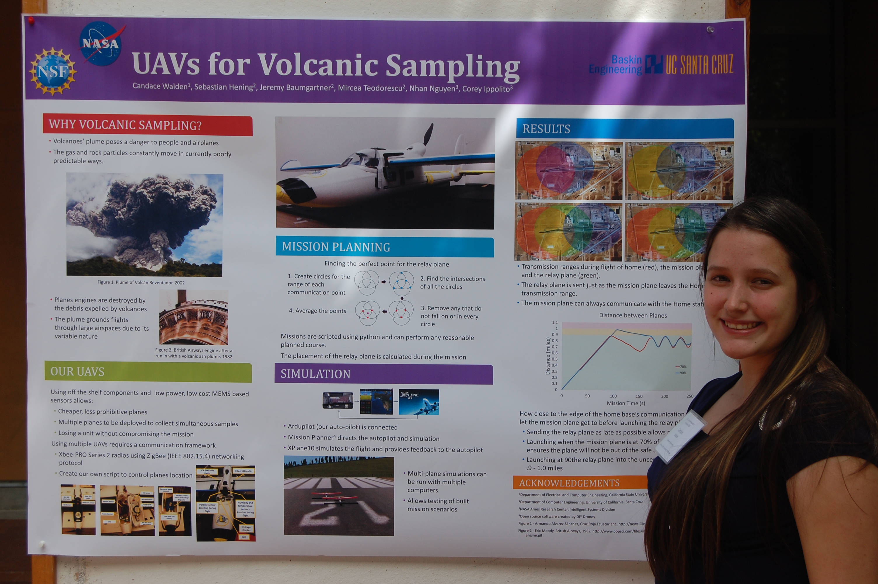
Candace Walden: Small UAVs for volcanic plume sampling
| Attachment | Size |
|---|---|
| 1.94 MB | |
| 2.68 MB | |
| 789.47 KB |
When volcanoes erupt thousands of pounds of ash and rock particles are ejected into the atmosphere. These particles can prove deadly for jet engines leading to large stretches of airspace off limits and thousands of flights grounded after each volcanic eruption. If we could more accurately track the areas affected by the volcanic soot, we could lessen the impact of each eruption while maintaining public safety.
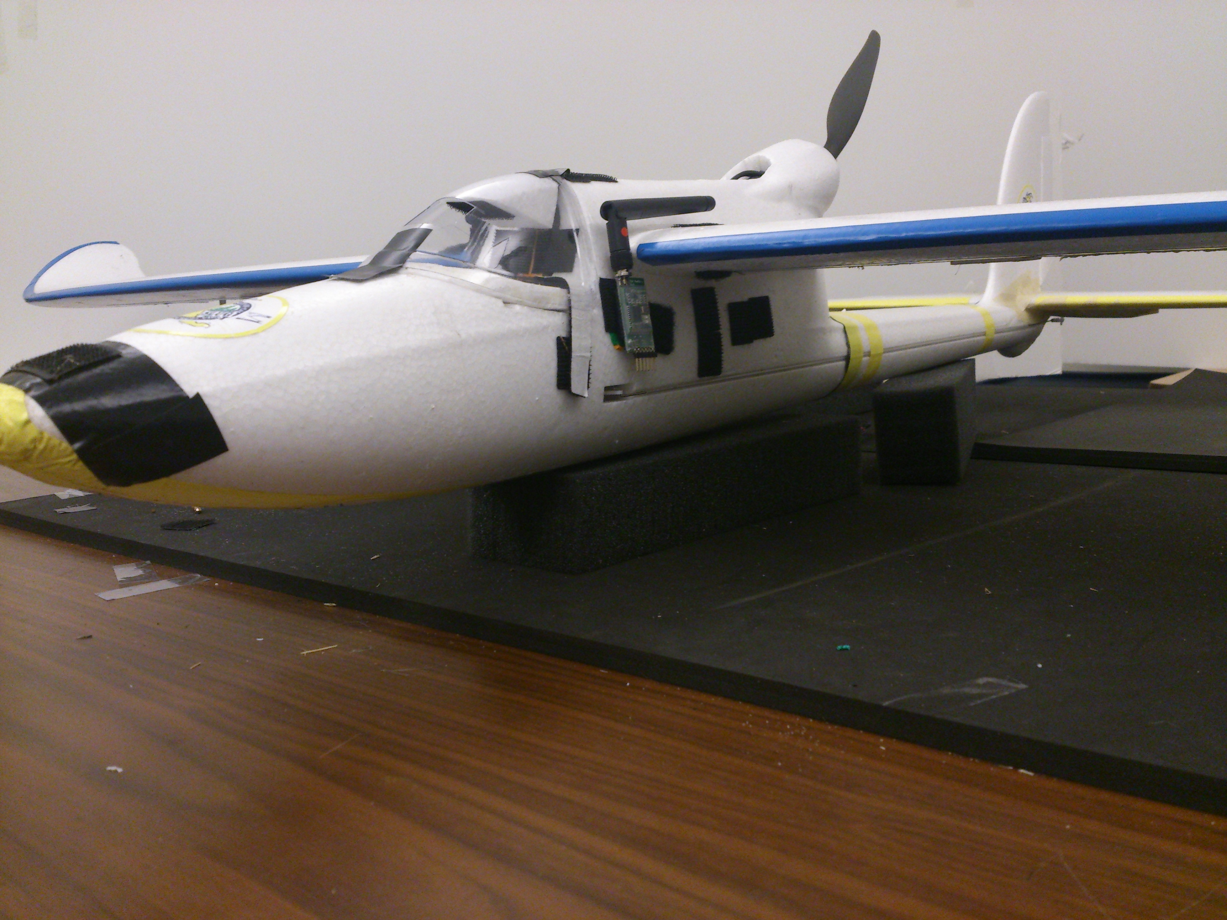
Small, inexpensive unmanned aerial vehicles (UAVs) constructed from off the shelf components can be used in coordinated teams to sample the airspace and provide an accurate picture of unsafe areas. The UAVs are constructed from hobbyist RC planes, where the remote control is bypassed by a programmable autopilot. These UAVs are equipped with sensors to detect particles and communication devices that connect automatically when close enough. I focused on creating programming that ensured the UAVs were always within communication range with the home base while flying a mission, either themselves or through a network of relay planes.