Michele Clarke: Let the Force Guide You: Map navigation for the blind and visually impaired
| Attachment | Size |
|---|---|
| 42.94 KB | |
| 563.07 KB |
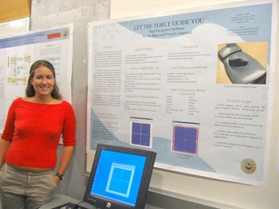
 Michelle participated in the 2004 Summer Undergraduate Research Fellowship in Information Technology (SURF-IT). She worked alongside Roberto Manduchi in a software design project to further mobility for the blind and visually impaired. Clarke's background working with the blind and visually impaired for many years has proven helpful in brainstorming exactly what users will need and look for.
As technology advances, the resources available to the blind and visually impaired struggle to keep up with the pace. Graphics, now a popular and even standard in today's society, continue to excel with little consideration for those unable to use them. This concern is especially apparent with current map reading and creation software. Recent studies geared toward advances in mobility for the blind and visually impaired explore the prospect of extending the accessibility of maps. Currently, map education and navigation is limited to tools such as hands on maps, printed Braille maps, and audio guides. The implementation of interactive products such as touch pads and force feedback mice or joysticks provide an interactive environment where the user can 'feel' their way through the map.
Progress at this point shows great potential in the success of future map navigation software. Currently users are able to 'feel' their way along designated paths of a pre-defined grid system. This is possible with the instantiation of impenetrable boxes that restrict the user from entering, thus forming a system of grooves which the user navigates amongst. Attraction points at path intersections alert users of their current position by providing a sensation of moving across a divot in the path. In future designs these attraction points will also contain optional audio commentary that provides location information. An invisible boundary wall also exists to keep users from unknowingly leaving the defined area.
In addition to these forces, users experience vector forces that pull them to a predefined position. Future designs will allow the user to designate both start and end points along the path grid. Vector forces will then guide the user between these points, providing necessary feedback along the way. Map creation will expand the usability of this software to accompany varying user needs.
As this is an ongoing project, Clarke plans to continue research at St. Mary's University of MN in collaboration with Manduchi throughout the 2004-2005 school year.